.svg "Greenhatch white logo (1)")
In the current era of rapid infrastructure development and complex land management, the ability to capture vast areas with absolute precision is a prerequisite for success. For large-scale projects, traditional surveying methods can often become time-prohibitive and technically limited. This is where a professional LiDAR survey provides a transformative advantage, offering a high-speed, high-density data capture solution that remains consistent across hundreds of hectares.

Advanced Light Detection and Ranging (LiDAR) technology captures precise, high-resolution geospatial data. By emitting hundreds of thousands of laser pulses per second, it creates a detailed 3D representation of any environment. Whether managing a national pipeline route or a major urban regeneration scheme, LiDAR ensures geospatial decisions are based on the most accurate data available.
One of the most significant challenges in topographical surveying is dealing with dense vegetation. Traditional photogrammetry often struggles to see through tree cover, leading to gaps in the data. However, a drone LiDAR survey overcomes this hurdle by using multiple-return laser pulses. These pulses can penetrate small gaps in the leaf canopy to reach the ground below.
This capability allows the generation of highly accurate bare-earth Digital Elevation Models (DEMs) in areas where other technologies fail. For developers and engineers, this means you can understand the true contours of a site long before any clearing works begin. A drone LiDAR survey provides the necessary insight for flood modelling, drainage design and route planning in challenging rural or wooded terrains.
Density And Precision Across All Variants
LiDAR is a versatile technology that adapts to the specific constraints of your site. While airborne systems cover vast areas quickly, terrestrial and mobile LiDAR variants provide an ultra-high density capture for intricate environments. Terrestrial scanning is the gold standard for capturing detailed building facades or complex industrial structures with millimetre precision.
When speed and scale are required for highways or rail corridors, our mobile mapping systems capture survey-grade data at traffic speeds. Regardless of the platform, the primary benefit remains the LiDAR survey accuracy achieved across the entire dataset. By using integrated GNSS and Inertial Measurement Units (IMU), we maintain tight tolerances over many kilometres, ensuring that your project’s vertical and horizontal alignments are flawlessly preserved.
Automated Classification For Targeted Analysis
A professional LiDAR survey produces a massive amount of information, often referred to as a point cloud. To make this data actionable for your design needs, we employ sophisticated automated classification algorithms. These tools separate the raw data into distinct categories, such as ground, vegetation, buildings and overhead utilities.
The result is a classified LAS file that allows for targeted analysis. For example, a civil engineer can isolate the ground class to perform precise volumetric change detection or earthworks calculations. Meanwhile, an environmental consultant might focus on the vegetation class for biomass assessment. This level of data organisation ensures that every stakeholder can extract the specific intelligence they need without wading through irrelevant noise.
Scalability For Monitoring And Modelling
The scalability of LiDAR makes it an ideal tool for long-term project lifecycles. Because we can capture high-density datasets repeatedly over time, LiDAR is perfect for deformation monitoring and structural health assessments. By comparing successive scans, we can identify millimetre-level movements in slopes, retaining walls or bridges.
This temporal data is also vital for flood modelling and volumetric analysis. Understanding how a site’s topography changes over time allows for more resilient infrastructure designs and better risk management. The consistent nature of LiDAR survey accuracy means that even when different teams perform scans years apart, the data remains comparable and reliable for multi-phase developments.
Enhancing Decision-Making With Technical Authority
At Greenhatch Group, we pride ourselves on being more than just data gatherers. We are a technical partner in your project’s success. With almost 40 years of heritage and field teams operating nationwide, we provide the responsiveness and expertise required for the UK’s most ambitious schemes. Our commitment to innovation ensures that we always utilise the most advanced sensors to reduce your site risks.
We provide full project lifecycle support, from initial data capture to BIM integration and setting out. We balance this technical rigour with an approachable service, making complex geospatial data clear and accessible for architects, engineers and planners alike.
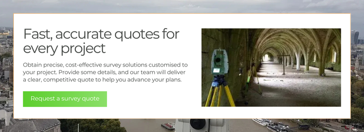
Streamline Your Project Outcomes With Greenhatch
Greenhatch Group combines 35 + years of experience in the geospatial arena with nationwide field capability to support complex, large-scale projects with precision and responsiveness. Using advanced LiDAR and geospatial technologies, projects benefit from accurate data capture. This technical rigour is matched with a clear, accessible approach, ensuring data can be confidently used by architects, engineers and planners.
LiDAR is an additional source of ground data, when coupled with traditional surveying, provides a comprehensive dataset for any project supporting design, accelerating decision-making and reducing the risk of costly on-site errors. From early feasibility to final facility management, detailed digital twins offer clarity at every stage. With the ability to deploy quickly across the UK, Greenhatch Group transforms complex environments into precise, actionable intelligence. Get in touch to discover how advanced LiDAR survey can support your next infrastructure or development project with greater accuracy, efficiency and confidence.
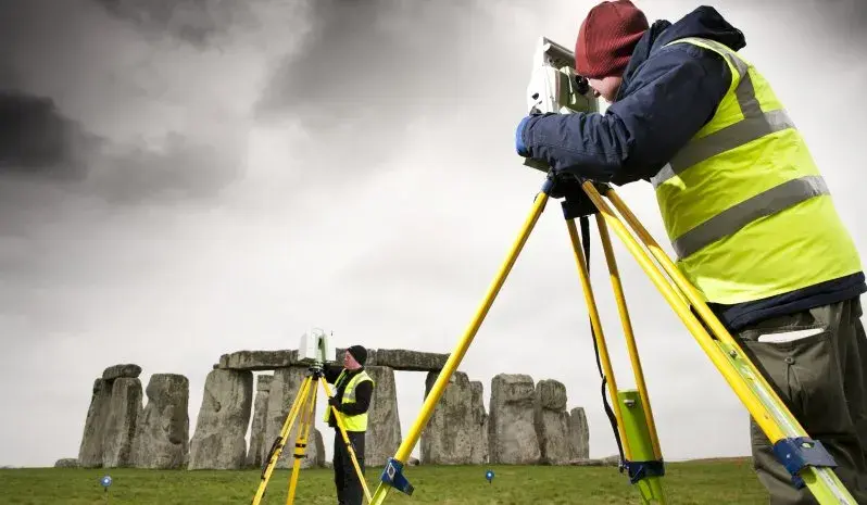
Stonehenge laser scan survey contract awarded to the greenhatch group

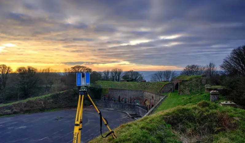
Z+F 5010 Laser scanner purchased by the greenhatch group
No Comments Yet
Let us know what you think