.svg "Greenhatch white logo (1)")

Specialist Underground Utility Survey for safe site planning
Accurate utility detection and mapping that helps you avoid costly strikes, reduce risk, and plan your project with complete confidence.


Greenhatch Group are able to offer a wide range of services to enable the detection, verification and location of underground services. Our surveyors in this field have been undertaking Underground Utility Surveys for over 10 years.
We are flexible to requests and can provide underground surveys across many environments which can include but are not limited to: -

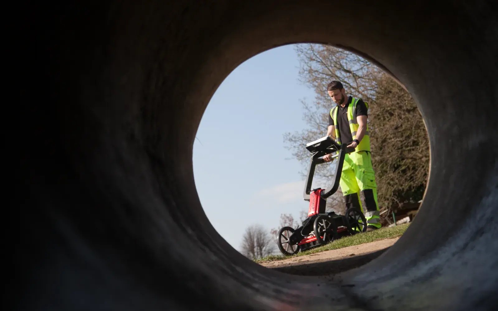
All our surveys are tailored to the client’s requirements, to fit in with project time constraints, to meet accuracy standards and to be delivered in the required digital formats, all at a reasonable cost. Having a centrally based office with two further well-placed offices, north and south, we are able to cover the whole country and maintain a quick and economical response to client enquiries. The company has experience of working further afield and has the capacity to undertake projects overseas.
GPR underground utility surveys
Underground Utility Surveys are undertaken using the latest surveying equipment and with highly trained surveyors. We use electromagnetic location kit (Radiodetection RD8100) as well as the latest dual frequency Ground Penetrating Radar’s (GPR) which allows us to undertake non-intrusive surveys to identify the location of buried services. We are able to produce real-time surveys with site mark up to physically show the location of buried services as well as fully compliant PAS:128 surveys.
To maintain standards and achieve the required project accuracy we work to the ISO9001:2015 quality assurance system where provisional data is field checked, computational and redundancy checks undertaken and final drawings production undertaken under the supervision of management with final quality checks undertaken on every project.
Underground surveys
Utilising the latest GPR technology
PAS:128 Surveys You Can Rely On
PAS:128 underground utility surveys from Greenhatch Group provide trusted, risk-based information to support safe design, planning and construction. By applying the standard proportionately and transparently, we help clients understand what lies below ground, how confident the data is, and how it should be used.
Drainage & CCTV Condition/Connectivity Surveys
The Greenhatch Group has been undertaking drainage CCTV surveys since 2010.
CCTV surveys are carried out by experienced surveyors using and working from fully equipped vans. All manholes will be lifted and surveyed prior to the camera being used to identify any faults. All information will be recorded as both a digital video and also as a report detailing any faults. These items will be linked to a digital drawing showing the routes of all pipe work. We can also offer jetting as an extra element if this is required on site.
Drainage & CCTV surveys include:
CCTV SURVEYS
DRAINAGE CONNECTIVITY SURVEYS
SONDE LOCATION SURVEYS
MANHOLE CARDS / FULL REPORTING
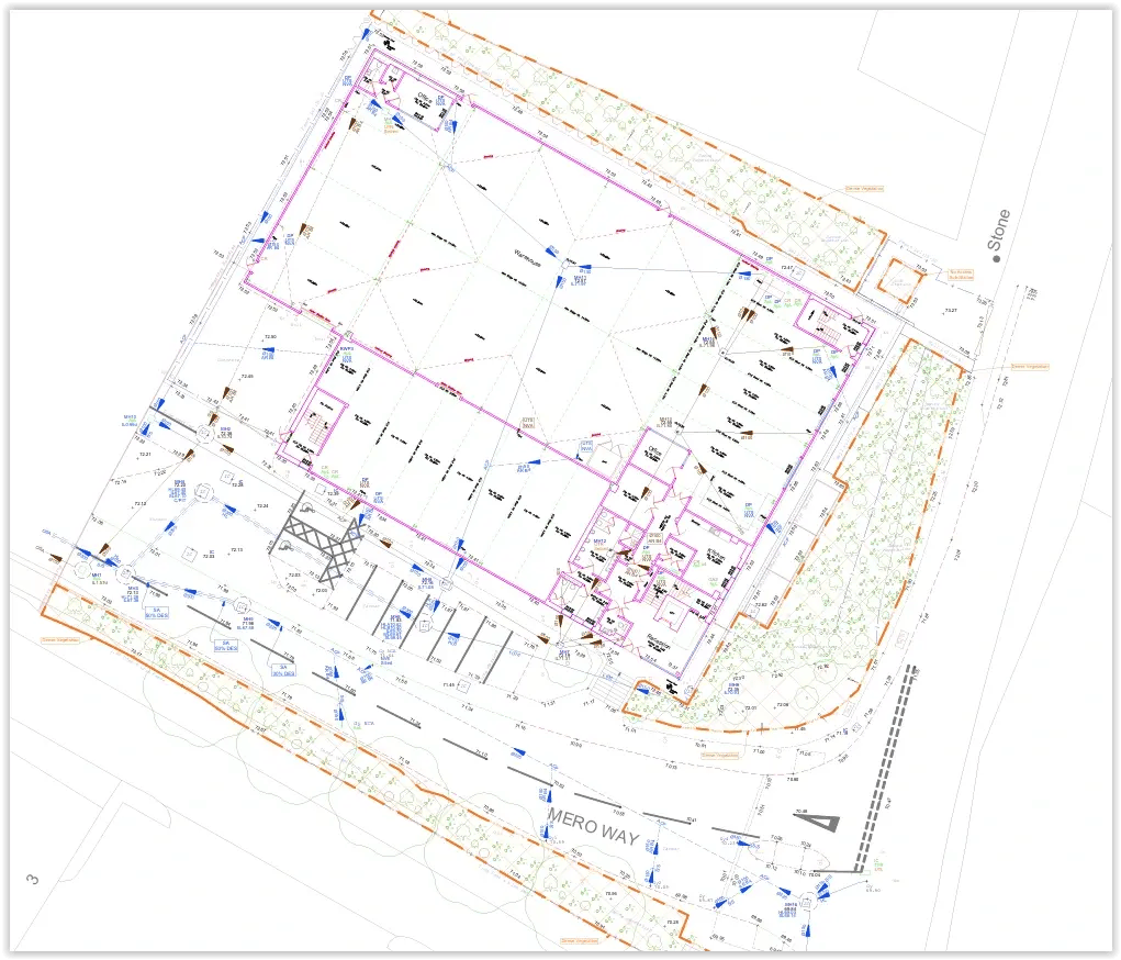
National coverage and international coverage
Committed in-house team
Employees, full training via CICES & custom programmes.
Years of experience
Pioneering surveying excellence from Derby to Newcastle, across the UK.
Surveys conducted
Starting from topographical to BIM models, a variety of surveys are conducted till date
Surveys Delivered
Request an Underground Utility Survey Quote
Tell us about your site and we’ll provide a tailored underground utility survey quote to help you reduce risk and plan with confidence.
Get fast, reliable data you can build on. Our expert team of surveyors delivers accurate results, backed by technology, insurance, and personal service that keeps your project on track.
When you choose us, you're choosing a partner who understands the pressures of tight deadlines, strict compliance, and complex sites. From heritage property to large-scale infrastructure developments, we provide the accuracy and confidence you need to design and build without costly setbacks.
Why choose us?
High-level insurance cover for complete peace of mind
Results delivered within tight timeframes
One project manager overseeing your survey from start to finish
Specialists in complex and large-scale projects
Complete the form today and our team will respond quickly with a tailored quote. Giving you clear, dependable data you can trust from day one.
Request a survey quote for your project
Get accurate geospatial data from a team trusted by architects, engineers, contractors, developers and local authorities across the UK.
From topographical and measured building surveys to 3D laser scanning, utility mapping, BIM and monitoring, Greenhatch provides the reliable data you need to plan, design and build with confidence.
Why choose Greenhatch?
✓ Established from 1988 surveying experience
✓ Nationwide & International coverage
✓ In-house survey specialists
✓ Clear project management
✓ Data delivered in the format you need
What Our Customers Say About Us
Frequently Asked Questions
An underground utility survey identifies and maps buried services such as gas, water, electricity, and telecoms. This information is essential before any excavation work, helping to prevent utility strikes, reduce safety risks, and avoid costly project delays.
Accuracy depends on the methods used, but we follow PAS 128 standards and use advanced detection technologies to provide the most reliable results possible. This ensures you have clear, dependable data to plan your project safely and confidently.
Our recent projects
Explore our projects and learn how they were delivered in an timely manner.
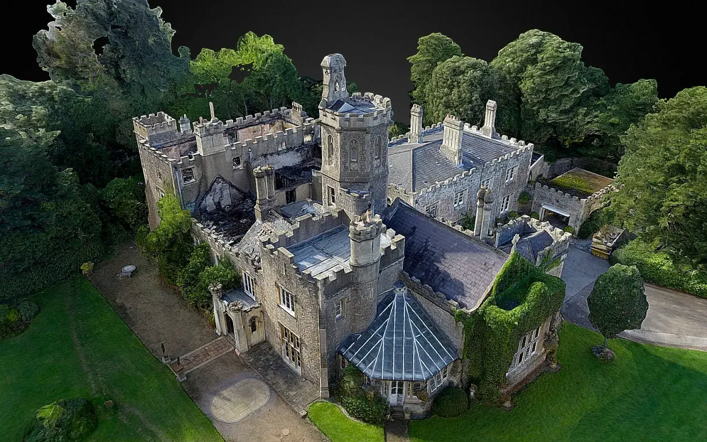
SfM photogrammetric survey, uphill manor, Weston Super Mare
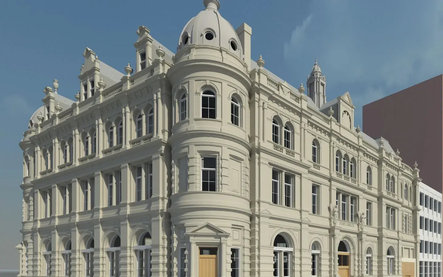
3D Revit model - former post office, dundee
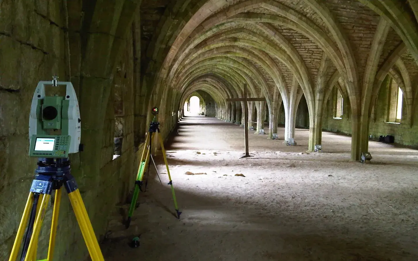
Fountains Abbey, Ripon, Yorkshire
.webp?width=150&height=150&name=C.I.C.E.S%20(Chartered%20Institution%20of%20Civil%20Engineering%20Surveyors).webp)
.svg)
.webp?width=150&height=150&name=R.I.C.S%20(Royal%20Institution%20of%20Chartered%20Surveyors).webp)
.webp?width=150&height=150&name=TSA%20(The%20Survey%20Association).webp)