.svg "Greenhatch white logo (1)")

A topographical survey is an essential starting point for many construction, engineering, and development projects. The survey creates a highly accurate map that records the natural and built features of a site. This includes boundaries, buildings, infrastructure, vegetation, drainage features, watercourses, contours, and spot levels. By capturing a true picture of the layout of the land, a topographical survey helps project teams understand the existing site conditions before any design or construction work begins. This information forms the foundation for informed decision-making, reducing uncertainty from the outset and improving efficiency through every project stage.

How Does A Topographical Survey Work?
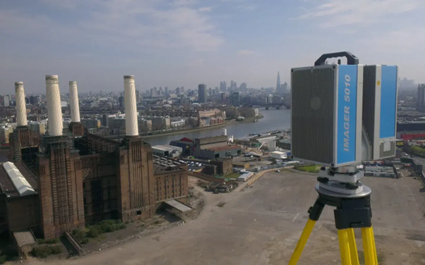
To deliver a reliable and accurate topographical survey, specialist surveyors use advanced instruments to record precise horizontal and vertical measurements. Common equipment includes total stations, GNSS receivers, and high-resolution laser scanners, as well as (increasingly) a range of UAV-based surveying systems. These instruments capture site data that is then referenced to a known datum, maintaining high accuracy and consistency across the entire site.
Once collected, the data is processed into detailed site plans and digital models that represent the land in three dimensions. These outputs create a dependable base on which architects, engineers, and developers can make informed design and planning decisions that align precisely with ground realities.
Why Topographical Surveys Matter For Project Planning?
If you are wondering ‘do I need a topographical survey’, the answer is usually ‘yes’ if your project involves any form of groundwork, structural design, planning submissions, or infrastructure installation. Architects, civil engineers, and developers rely heavily on accurate survey information to understand the ground conditions, drainage patterns, access points, visible utilities, and legal boundaries associated with a site.
By identifying these constraints early and eliminating guesswork, a topographical survey reduces the risk of delays, redesigns, and unexpected project costs. It also gives every stakeholder a shared understanding of the site’s physical characteristics, improving clarity, safety, and compliance across the project lifecycle. The result is a better-informed design process, enhanced coordination, and smoother progression from concept to construction.
How Is Topographical Survey Data Used?
Topographical surveys support a wide range of applications, from everyday site planning to complex engineering projects. For example, survey outputs are routinely used to create BIM models, prepare planning submissions, design infrastructure layouts, and coordinate multidisciplinary design work. These digital and paper-based deliverables allow project teams to work from a single, accurate reference point, maintaining consistency throughout the design and construction process.
Do You Need To Commission A Topographical Survey?
A topographical survey is beneficial at many stages of development, but it becomes essential in several key scenarios. For example:
You are preparing a feasibility study or early development assessment.
- A topographical survey provides the baseline information needed to understand site constraints such as gradients, natural features, and access limitations. This helps you assess suitability and viability before progressing to detailed design.
You are getting ready to submit a planning application.
- Most planning authorities expect your drawings to reflect real site conditions. A topographical survey ensures compliance, reduces queries, and improves the accuracy of supporting documents.
You are designing a new build, extension, or redevelopment.
- Accurate level data, boundary locations, and existing building positions allow architects and engineers to design safely and efficiently, reducing the risk of incorrect assumptions or unexpected site conditions later.
You need to manage drainage, flood risk, or surface water flow.
- Spot levels, contours, and water features are vital for designing effective drainage solutions. Without precise information, systems may be under-designed or incorrectly positioned.
You require accurate information for access, logistics, or site setup.
- A topographical survey helps contractors plan access routes, storage areas, and temporary works safely by identifying obstructions, gradients, and infrastructure constraints.
You need a reliable base for BIM models or multidisciplinary coordination.
- For larger projects, accurate survey data supports collaboration by ensuring every discipline works from the same geospatial information, reducing clashes and inconsistencies.
You are developing infrastructure or upgrading existing assets.
- Infrastructure schemes rely on precise mapping to integrate new works with existing networks and avoid conflicts during construction.
Next Steps: Speak To Our Specialists About Your Topographical Survey Requirements
A professionally executed topographical survey gives your project the accuracy, confidence, and reliability it needs from day one. Greenhatch combines cutting-edge survey technology with experienced geospatial specialists to deliver precise and dependable results across every sector. Whether your focus is early feasibility, detailed design, or infrastructure delivery, our team can provide the insights you need to plan smarter and build with certainty. To discuss your site, explore survey options, or request a tailored quotation, contact the Greenhatch team. Our survey specialists are ready to help you achieve the clarity and assurance your project deserves.
What Is The Step-by-Step 3D Laser Scanning Process?
.jpg)
What Is A Measured Building Survey?
.jpg)
No Comments Yet
Let us know what you think