GPR Underground Utility Surveys
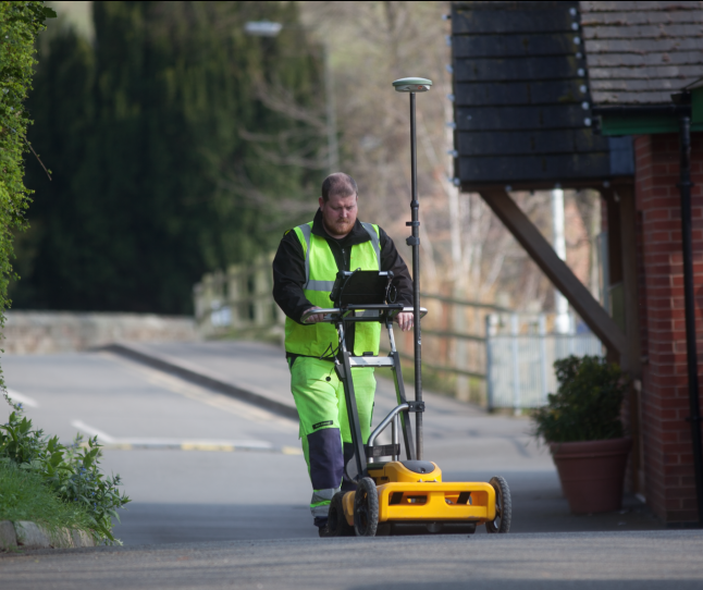
Underground Utility Surveys are undertaken using the latest surveying equipment and with highly trained surveyors. We use electromagnetic location kit (Radiodetection RD8100) as well as the latest dual frequency Ground Penetrating Radar’s (GPR) which allows us to undertake non-intrusive surveys to identify the location of buried services. We are able to produce real-time surveys with site mark up to physically show the location of buried services as well as fully compliant PAS:128 surveys.
To maintain standards and achieve the required project accuracy we work to the ISO9001:2015 quality assurance system where provisional data is field checked, computational and redundancy checks undertaken and final drawings production undertaken under the supervision of management with final quality checks undertaken on every project.
Underground Surveys
Utilising the latest GPR technology
SPEAK TO ADAM SNEDDON OUR UNDERGROUND UTILITY SURVEY EXPERT ON
+44 (0) 1332 830044
OR EMAIL YOUR ENQUIRY
GPR UTILITY SURVEYS INCLUDE:
PAS:128
GPR & POST PROCESSING
CCTV
BOREHOLE CLEARANCE
CONFINED SPACES ENTRY
DRAINAGE CONNECTIVITY
STATUTORY RECORD SEARCH
RESOURCES USED:
ELECTROMAGNETIC LOCATION EQUIPMENT (CAT & GENNY RD8100)
GROUND PENETRATING RADAR (MALA / DS200)
SONDE
TRIMBLE SX10 GPS
MAGNETIC MANHOLE LIFTING